In the spring of 2013, funded by a grant from the Needham Community Preservation Committee, BCRTA engaged Fay, Spofford & Thorndike (FST) to prepare a Conceptual and Planning Design Study for the “Southern Section” of ROW from the Charles River at the Needham/Dover Town Line to Needham Junction. The goal of this study was to address the major items of technical interest and concern along the corridor which include, but are not limited to, trail cross section, parking and access, at-grade crossing treatments, Charles River Bridge, and abutter mitigation measures.
This study was prepared with a cross section of community input and direction. Members of the BCRTA and Park & Recreation Department directed the process. Two public information meetings were held in March and April 2013 to gather information and present the initial study results for public comment. An interdepartmental coordination meeting was held with the Park & Recreation, Public Works, Conservation, Police, and Fire Departments.
The results of the study can be viewed and downloaded (as PDF) here.
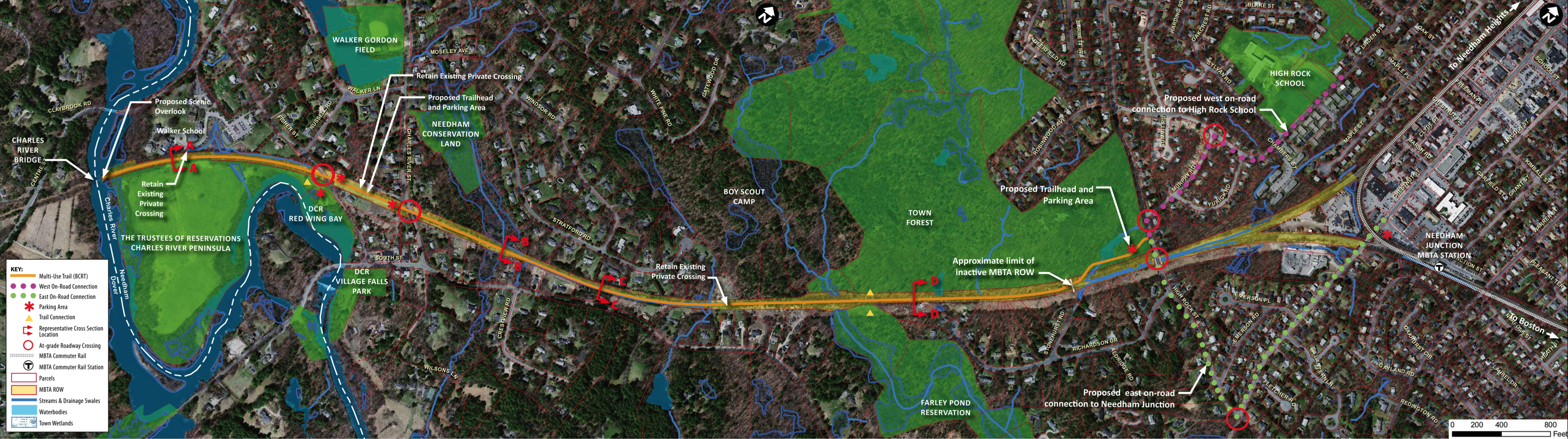
The graphical annotated overview of the trail can be viewed in detail by clicking the image below.